Publications in Irion
| Title | Publication Year Sort ascending | Abstract | Author | Series | Publisher | |
|---|---|---|---|---|---|---|
|
Upper Pennsylvanian and Lower Permian Shelf-to-Basin Facies Architecture and Trends, Eastern Shelf of the Southern Midland Basin, West Texas | 2017 | Our study documents the shelf, shelf-edge, slope, and basin-floor depositional facies characteristics, stratigraphic variations, and sedimentation trends of the Missourian Canyon Group and Virgilian–Wolfcampian Cisco Group across the southern Eastern Shelf and the adjacent Midland Basin. |
Hentz, T.F., Ambrose, W.A., Hamlin, H.S. | Report of Investigations | Bureau of Economic Geology |
|
Stratigraphic analysis of the Upper Devonian Woodford Formation, Permian Basin, West Texas and southeastern New Mexico | 1991 | The Upper Devonian Woodford Formation is an organic-rich petroleum source rock that extends throughout West Texas and southeastern New Mexico and currently is generating oil or gas in the subsurface. |
Comer, J.B. | Report of Investigations | Bureau of Economic Geology |
|
Integrated characterization of Permian Basin reservoirs, university lands, West Texas: targeting the remaining resource for advanced oil recovery | 1991 | Unrecovered mobile oil is oil that is movable at reservoir conditions but is prevented from migrating to existing we1 l bores because of geologic complexities or heterogeneities. |
Tyler, Noel, Bebout, D.G., Garrett, C.M., Jr., Guevara, E.H., Hocott, C.R., Holtz, M.H., Hovorka, S.D., Kerans, Charles | Report of Investigations | Bureau of Economic Geology |
|
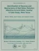
Identification of sources and mechanisms of salt-water pollution affecting ground-water quality: a case study, West Texas | 1990 | Occurrences of ground-water and soil salinization are numerous in the Concho River watershed and its confluence with the Colorado River in West Texas and in other semiarid regions of Texas and the United States. |
Richter, B.C., Dutton, A.R., Kreitler, C.W. | Report of Investigations | Bureau of Economic Geology |
|
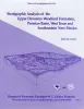
Depositional framework of the Lower Dockum Group (Triassic), Texas panhandle | 1979 | The Upper Triassic Dockum Group of Texas and New Mexico is composed of 200 to 2,000 feet of complexly interrelated terrigenous clastic facies ranging from mudstone to conglomerate. |
McGowen, J.H., Granata, G.E., Seni, S.J. | Report of Investigations | Bureau of Economic Geology |
|
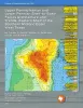
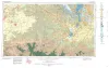
Geologic Atlas of Texas, San Angelo sheet | 1974 | Geologic map that depicts the surface geology of Tom Green, Irion, and Reagan Counties and parts of Midland, Glasscock, Sterling, Coke, Runnels, Concho, Menard, Schleicher, Crockett, and Upton Counties, Texas. |
Barnes, V.E., Eifler, G.K., Shell Oil Co., Southern Minerals Corp., Humble Oil and Refining Co., Cannon, Joe, Brown, W.J., Swartz, G.D. | Geologic Atlas of Texas | Bureau of Economic Geology |