Publications in Fisher
| Title | Publication Year Sort ascending | Abstract | Author | Series | Publisher | |
|---|---|---|---|---|---|---|
|
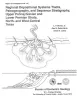
Regional depositional systems tracts, paleogeography, and sequence stratigraphy, Upper Pennsylvanian and Lower Permian strata, north- and west-central Texas | 1990 | Sixteen depositional sequences, commonly called cyclothems, each composed mostly of limestone(retrogradational/transgressive) and siliciclastic (progradational/regressive) subsequences, or systems tracts, record the paleogeography during Late Pennsylvanian (Virgilian Epoch) and Early Permian (Wol |
Brown, L.F., Jr., Solis-Iriarte, R.F., Johns, D.A. | Report of Investigations | Bureau of Economic Geology |

|
Hydrogeology and hydrochemistry of the Ogallala aquifer, southern High Plains, Texas panhandle and eastern New Mexico | 1988 | The Ogallala aquifer, which underlies the Southern High Plains, consists of the saturated sediments of the Neogene Ogallala Formation. The aquifer is the main source of water for the High Plains of Texas and New Mexico and is being severely depleted by extensive pumpage for irrigation. |
Nativ, Ronit | Report of Investigations | Bureau of Economic Geology |
|
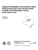
Regional stratigraphic cross sections, Upper Pennsylvanian and Lower Permian strata (Virgilian and Wolfcampian Series), north-central Texas | 1987 | This cross section set comprises 14 dip (E-W) sections and 9 strike (N-S) stratigraphic cross sections (with text), correlating upper Pennsylvanian (Virgilian) and lower Permian (Wolfcampian) strata throughout the subsurface in all or parts of 28 counties of North-Central Texas. |
Brown, L.F., Jr., Solis-Iriarte, R.F., Johns, D.A. | Cross Sections | |
|
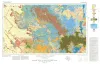
Bouguer gravity Atlas of Texas, Big Spring sheet | 1986 | This folded transparent map is at the same scale as its corresponding Geologic Atlas of Texas (GAT) sheet and can be superimposed on it to compare gravity information with surface geology. |
Keller, G.R., Aiken, C.L.V. | Bouguer Gravity Atlas of Texas | Bureau of Economic Geology |
|
Depositional framework of the Lower Dockum Group (Triassic), Texas panhandle | 1979 | The Upper Triassic Dockum Group of Texas and New Mexico is composed of 200 to 2,000 feet of complexly interrelated terrigenous clastic facies ranging from mudstone to conglomerate. |
McGowen, J.H., Granata, G.E., Seni, S.J. | Report of Investigations | Bureau of Economic Geology |
|
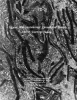
Upper Pennsylvanian limestone banks, north central Texas | 1975 | Nelson and others (1962) define a bank as " ... a skeletal deposit formed by organisms which do not have the ecologic potential to erect a rigid wave-resistant structure." They explain that a bank may have any geometry. |
Wermund, E.G. | Geological Circular | Bureau of Economic Geology |
|
Geologic Atlas of Texas, Big Spring sheet (revised 1994) | 1974 | Geologic map that depicts the surface geology of Borden, Scurry, Fisher, Martin, Howard, Mitchell, and Nolan Counties and parts of Glasscock, Sterling, Coke, Runnels, Taylor, Jones, Dawson, Martin, Lynn, Garza, Kent, and Stonewall Counties. |
Eifler, G.K., Frye, J.C., Leonard, T.F., Barnes, V.E., Trollinger-Gusney and Assoc., Shell Oil Co., Humble Oil and Refining Co., Southern Minerals Corp. | Geologic Atlas of Texas | Bureau of Economic Geology |
|
Depositional systems and shelf-slope relationships in upper Pennsylvanian rocks, north-central Texas | 1972 | The Eastern Shelf was a constructional platform developed on the margin of the sediment-starved Midland Basin during Late Pennsylvanian and Early Permian time. A mixed terrigenous-carbonate sedimentary province characterized the shelf during most of its history. |
Galloway, W.E., Brown, L.F., Jr. | Report of Investigations | Bureau of Economic Geology |
|
Lower Cretaceous sands of Texas: stratigraphy and resources | 1967 | Lower Cretaceous sands have long been important aquifers in Central, North-Central, and North Texas. In recent years these sands also have been sources of high-silica industrial or specialty-purpose sand. |
Fisher, W.L., Rodda, P.U. | Report of Investigations | Bureau of Economic Geology |
|
Stratigraphic and structural studies in north central Texas | 1929 | Cheney, M.G. | UT Bulletin |